 Photo #1: Sunrise on the Gulf, one of the rewards for taking that 2 - 6 a.m. watch.
 Photo #2: Beautiful afternoon clouds, one of the rewards of taking a daytime watch.
[Hilde’s log]
I am sitting below decks mourning the death of our air conditioner. It passed away quietly our last day in Pensacola, and brother do I miss it. It’s 11:00 a.m. and 93 degrees. We must be back in Seabrook!
We had a challenging and beautiful passage from Pensacola to Galveston. If I were to title the trip, I’d call it Thunderstorm Alley. Four of our six days out were plagued with storms: huge, monstrous, glorious, terrifying, and beautiful. In addition to the thunderheads and lightening, we saw several water spouts. For contrast, two of the days we were out, it was just flat calm in all directions. We hardly sailed at all the entire trip and I was so glad we thought to add two extra cans of diesel fuel to the deck. We ended up using our entire tank, plus all we had on deck, and cruised into Galveston with 8 gallons left.
All the way across the Gulf from Pensacola our days were spent playing dodge ‘em with the mountainous thunderheads and our nights were spent playing dodge ‘em with lightening bursts. We were lucky, only coming close to one big storm. That was scary enough, as the black clouds converged on our position from two directions, churning five foot seas in every direction. With life jackets donned, we alternated between sitting on the cabin sole (me praying nonstop) and sticking our heads up to see what was going on. It was more scary looking than actually dangerous (other than the lightening), with top winds of only 34 knots. The lightening, though, was ferocious for the entire trip.
Cloud to cloud lightening would light up the sky for miles, illuminating the storm clouds and the sea. The “bad” lightening was the cloud to ground sort, enormous bolts visible for miles that stabbed the sea in sudden bursts. We measured the position of the night time storms from the cloud to ground lightening, and once we determined which way the storm was headed, we went perpendicular and ran like hell. You know the saying “There are old sailors and bold sailors, but no old bold sailors.” We intend to get old.
Out of Pensacola the storms chased us south so far that we totally gave up on the fairways and just headed out to deep water. It’s so much better far off shore anyway, because it takes a lot of wind to stir up deep water. The sky was magnificent, full of the Milky Way. Most of the time we seemed to inhabit a charmed circle of clear sky, with thunderheads all the way around us. All day long I’d watch them build and collapse, like soufflés in a nautical oven.
The most appalling storm was the one we encountered when we were about 100 miles out of Galveston. The sky in front of us (landward) was dark, featureless gray, like a gray blanket over the entire horizon. At sunset and we couldn’t see the sun at all until it touched the ocean, and then it was a vermillion fireball for a few seconds before disappearing. NOAA radio reported a huge thunderstorm galloping out the ship channel from Houston to Galveston to parts SW at 30 miles per hour. I was so glad we had made such slow progress across the Gulf; otherwise we might have found ourselves in the middle of that storm coming in. It was a huge system, spewing lightening from one side of the horizon to the other. We were relieved to watch it pass to the SW as predicted (we were headed NW) and we never even had any rain from it. Another storm threatened our starboard quarter for most of the night, but it eventually faded away to the NE. I have yet how to account for the movement of storms relative to the wind direction on the boat.
Thanks to our Fugawi charts (the best charts, as far as I can tell) we knew to follow the shipping lanes (called the fairways) along the coast once we passed South Port, Louisiana, and so it was easy to stay away from the oil wells, the supply boats and the truly enormous mooring balls used by the supply ships (easily the size of a Hummer). The wells are really beautiful at night, lit up like casinos – provided they are lit up. There are occasional wells that are not lit, and those are the scary ones. That’s one reason we have made both our Gulf crossings under a full moon. We saw two unlit wells this trip.
The fairways are like sea going freeways, and are used by the commercial ships as they go to and fro. They are great to follow, because when you see a big ship coming, you pretty much know which way it is headed. We had one oil tanker cut behind us and two cut in front of us, but other than that they all behaved themselves and chugged down the road. The commercial traffic on the Gulf is terrific when you are within 100 miles of shore. We had forgotten! It was a lot like driving through a well populated country area on a highway, with the lights of the farm houses scattered all around and the lights of the 18 wheelers going up and down the road with you. Many of the captains are not native English speakers, so when you are trying to listen to the traffic on 16, language can be an issue. Actually, language is an issue when you listen to the barge traffic on the GIWW. Those men all speak with a weird southern patois/good old buddy accent that I am hard pressed to understand, and I’m from here.

Photo #3: This is what the lit oil rigs look like at night...

Photo #4: This is what they look like in the distance during the day (see that little spot?)...
 Photo #5: This is what they look like up close...
 Photo #6: And this is what they look like when I am not paying attention on watch and we get too close! Note the supply boat at right. That boat is enormous and it is dwarfed by the rig.
All the way across I was thrilled to be back on the Gulf. I grew up in Houston, and the Gulf is “home.” The sky looks right, the water looks right, the oil rigs look right – well, you know how home is, warts and all; there's no place like it. The Gulf is also one of the most beautiful places on earth, whether you are dodging oil wells near shore or are out on the flat expanse of blue that opens up about 150 miles out.
It was great fun to come into Galveston, despite our grueling passage in. Contrary wind and current made the water rough and because the blasted self steering died about 30 miles from the outer mark, we had to hand steer, one hour on and one hour off, for the next 12 hours. The good news is that it was blessedly cool from all the storms that passed through before we got in. We motored down the gauntlet of at least 50 ships at anchor on either side of the fairway, waiting to be called in to the Port of Houston. Raven reached the jetties about 7 a.m. and caught a rising tide into the bay. We had the yankee out and the engine on and she scooted through the jetties at 8.3 knots, past the anchored tankers and into the anchorage at Teacup, where we pulled into the closest marina for fuel. There were a couple of fishing boats tied up as well, and the fishermen and women were cleaning a catch, surrounded by a screeching cloud of gulls, pelicans, and cormorants. The birds were busy catching and eating the culls from the catch (which looked like eels), literally pulling them out of each others’ mouths.
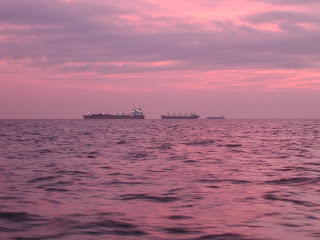 Photo #7: Three of the over 50 anchored ships we passed just off the fairway near Galveston in dawn's early light.
 Once we filled up with diesel we eased back out into the anchorage at Teacup and David checked the oil. Then we headed north up the channel for four hours to the anchorage at Red Fish Island where we spent a very hot afternoon and evening. Then this morning we came in, and our first slip at Watergate was awful. They are obviously waiting for the next storm to take out those docks, which were old, narrow, fixed, wooden, and full of splinters. Ick. David got us moved temporarily to the new floating docks, which is a much better location and easy step on-off to Raven's deck.
 Photo #8: Boats anchored at Red Fish Island. The island is man-made (spoil) so there is no vegetation, no shade, and no bugs. You do have a great view of the channel traffic, as you can see. The wake from these huge ships washes over the island like the surf over the rocks on the West Coast!
 It was so much fun to sail (no, motor, the wind never did cooperate) up the channel and into the bay and under the Kemah bridge. All that trip used to just terrify me and it was fun coming in and recognizing everything and not being a bit scared. Just hot. It is, after all, Texas in June.

Photo #9: Oh my gosh! It's me, steering Raven across the bay and I actually know what I'm doing! Notice the kerchief - it's soaked in ice water. It's hot.

Photo #10: then we see the Kemah boardwalk... (new roller coaster there!)

Photo #11: under the Kemah bridge...

Photo #12: Where it all started, two years, two months and 8 days ago. Our slip was opposite "Tres Amigos" here in Seabrook. Unfortunately, they were full, so we are docked at Watergate, just up the way.
No comments:
Post a Comment