Thursday, May 31, 2018

Ten Days on the Road, er, Creek

[Hilde’s log]

Never underestimate the value of dry, clean sheets! After ten days "on the road" we pulled into Harborwalk Marina in Georgetown, SC, plugged into the AC, and stripped every bit of cloth from the boat. Five loads of laundry and four hours later, we sank gratefully onto the settees and gloried in cool, dry air, clean bodies, and dry bedding. Ahhhh. We sure enjoy being plugged in when it happens.

Since Beaufort, we've traveled ten days straight without coming in to land, with the exception of a brief stop at Isle of Palms for diesel and water. Raven chugged right by Charleston without any desire to stop. We were there two weeks ten years ago, and although we have fond memories of the old city, weren't tempted to stop this time.
Instead, we kept going and pulled out to anchor in Whiteside Creek, north of the city. Another on our list of beautiful places, we ended up staying two nights.

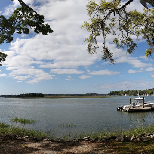
Glamor shot of me filling the water tank. We stopped at the fuel dock at Isle of Palms, just north of Charleston, for diesel and water and potato chips. The essentials.

Sunrise, Whiteside Creek, our first anchorage north of Charleston.

On lazy mornings, when the tide doesn't rise until noon, David gets a much better breakfast!

We spent the whole day at anchor, again seduced by the still beauty all around us, broken by the occasional deer fly, bent on a quick snack. SWAT. The next morning we motored another 15 miles to Awendaw Creek.
Our next stop found Raven floating at anchor about as close to the Atlantic as you can get, without being actually out in the Atlantic, in Awendaw Creek. Just across the marsh and nestled in among the trees, I could see a few houses, but if I looked in the other direction, all I could see was the slim outline of some barrier marshes and the sparkle of light on the water. If you have followed the “breadcrumb trail”, you will have seen this place, where it looks as though we were anchored in the ocean.

Both days of travel north from Charleston were marked by a parade of Hatteras fishing boats. These are high dollar fishing vessels, and we were passed by at least ten of them, coming in clumps down the ICW, throwing high wake to either side of the canal. All were well-captained and obligingly slowed down as they went past. We just scratched our heads at the sheer numbers. Headed south for a boat show? Fishing tournament? Breeding season? Who knows.

One of the Hatteras boats that passed us. These bad boys cost about $1 million per boat... Also, what is the plural of Hatteras? Hatteri?

Awendaw Creek stuck in our minds as one of the memorable anchorages from our trip south a decade ago. We anchored here in December, and I remembered the oyster reefs where we tentatively went ashore to pee our schnauzer, Schnitzel, me keeping a wary eye out for alligators even in that cold air. The water was looking-glass still at night, and I remember the carpet of stars above us, shards of twinkling glass in that clear, cold sky, all of which were reflected in every detail in the black, still water around us. It was like floating free in a star field.

Awendaw Creek is a wide-open anchorage.

The view was totally different this time. We were surrounded by green marsh grass and trees in full leaf. The wind kicked up, and Raven danced at anchor the whole time we were there.


Looking across the marshes from Awendaw Creek, you can see houses peeking through the trees.

An egret looks for lunch amid the oyster beds. This is what we waded through to take the dog ashore all those years ago.


With high winds forecast, I did not feel at ease with so much open space around us, so after only one night we moved on to Minim Creek, motoring by the Francis Marion National Forest and the Santee Coastal Reserve, wilderness on both sides of the canal. (see below)


The rain that had been dogging us for a week finally caught us at Minim Creek. David did manage to rig the sail kit on our dinghy and puttered around the creek, but later in the afternoon the clouds closed in and we sat through about 24 hours of heavy showers. The mosquitoes were out in force, and somehow found ways in through our screens. We carried several of the big, black, toothy insects with us all the way up Winyah Bay to Georgetown.
Technology has changed so much about cruising in the last ten years. We've had cell phone access in almost every anchorage (not Minim Creek, where we really wanted to know when the rain would clear out). Internet access has taken much of the mystery of traveling with the tides and gives us instant access to weather and wind strength along the way. Instead of consulting a battered tide book to determine when to travel up or down a river, or over shallow spots in the ICW, we have instruments on board that show us exactly where we are in the tide cycle at our present position.

I can upload photos and post the blog almost anywhere, instead of having to wait to hook up to a marina’s questionable wi-fi, or having to lug the computer to the local library for internet access. In most areas we can make and receive telephone calls with ease, even video-calls.

We can watch TV on our phones almost every night, if we want to, not to mention calling ahead to make reservations at upcoming marinas or to alert fuel docks that we are approaching. It’s a lot less like traveling by covered wagon, and a whole lot more like driving an RV along a highway through a national park, although the views on the water remain unsurpassed.


Nice improvements! Now, if I could just figure out how to keep the sheets from getting soggy.


Friday, May 25, 2018

Blessed Quiet

[Hilde’s log]

Our path from Beaufort took us from the Beaufort River north up the Coosaw River, across St. Helena Sound, then through the Ashepoo-Coosaw cutoff (where we stopped short to avoid being creamed by a giant container ship) to the Ashapoo River. Angling through the Fenwick Cut, we anchored in about 20 feet of water in the South Edisto River, beside Fenwick Island. I keep these details because, although we know we came down this way ten years ago, I have absolutely no memory of the area, other than one or two anchorages that have stuck in my head. So this time I am keeping track. Off Fenwick Island, we anchored next to friends Ann and Tony on Stella Maris. The next morning, they set off for Charleston, but the area was so incredibly calm and beautiful we couldn’t bear to leave, so we spent a lovely day floating alone, marshes and woodlands on either side of the wide expanse of water.

The birds in the trees sang all day.

A glorious break of day.

This whole area is gorgeous and makes the trip worthwhile. As a refugee from a metropolitan area of over 12 million, and as a life-time reluctant city dweller, I delight in the absence of human buildup. There are houses scattered over these islands, but they are not, for the most part, intrusive, and many areas seem deserted (I know they aren’t, but I pretend).

Anchoring in a remote area is so restful to the soul. My favorite time of day is the early morning, when the soft, cool morning air is filled with birdsong from the neighboring trees and the only other sound is the gurgle of the current against Raven’s hull, the slap of waves on the nearby shore, and the croak of the occasional frog. Air that has only been breathed by trees and the sea is simply intoxicating, like a crisp chardonnay for the lungs. The absence of all sounds of mechanization makes me go limp with relief. We can usually enjoy about two hours of “silence” before the fishing boats break into our little cocoon of quiet. I am ridiculously territorial, resenting any intrusion by anyone into our solitude.


The next leg of the trip took us from the South Edisto River through Watts Cut to the Dawho River, which spills into the North Edisto River. That turns into Wadmalaw Sound, and we turned off there to anchor in Church Creek. As we left our anchorage across from Fenwick Island, we noticed quite a build up of black clouds to the west. A check of the radar revealed a nasty little clump of rain cells that was passing us to the north and west. It dogged us all day, sometimes nearer, sometimes farther away. Only one shower found us, but I couldn’t believe the rainstorm was moving as slowly as we were. There was no lightening, so it wasn’t scary – in fact, made for pretty good pictures!


I should mention here that David is our resident photographer. If you see a good photo, he’s usually the one who took it. I get lucky sometimes, but often steal his shots as they are usually better than mine. Credit where credit is due! Also maybe this will poke him to do a blog entry. (Ahem.)

Typical pose of our resident photo-guru.

Today as I write this, we are at anchor in Church Creek, one of seven boats who chose to spend the night here. Yeah, crowded. Sigh. You will see how silly I am when you see how far the other boats are from us, but still. We are waiting for the tide to rise, as some of these cuts are notoriously shallow – so why stress?

Our "crowded" anchorage in Church Creek. We were one of seven boats.

This morning as we had our tea on deck, we think we heard a loon call. Google informed us that yes, there are loons as far as South Carolina in May. I was amazed; I thought they stayed in the far north. Other informative tidbits: they are a very large bird (5 foot wingspan), are not related to ducks, have solid bones, and have been around for about 65 million years.

Morning tea. Side order of foot, optional.

ATTENTION EU SUBSCRIBERS

Attention EU subscribers!

When you visit this blog, please note that Google uses certain Blogger and Google cookies, including use of Google Analytics and AdSense cookies. If you don't want them to use these cookies, please unsubscribe to this blog. I have no way of knowing who is subscribed! Blogspot does not give me a list of subscribers. I am sending this as a post, knowing that everyone who subscribes will get it. There is an unsubscribe line at the bottom of each emailed post.

Thursday, May 24, 2018

Wandering through South Carolina - Beaufort

[Hilde’s log]

First views of South Carolina, palms and pines.

I’m thinking of changing Raven’s name to Drifter, due to our very leisurely attitude since leaving Savannah (Just kidding; we’d never change her name!) Our first day out of Savannah, we managed a whole five miles, then plopped into a broad, marsh-lined creek and set the hook. The next day we wandered another 15 miles or so, and the third day we arrived in Beaufort, South Carolina. The good news is, we caught a mooring ball at the city marina. The bad news is, we arrived tired at the end of the day in 20 knot winds. I had to fight contrary wind and river current while David wrestled with catching the ball. On the best days we aren’t very graceful with this maneuver; that afternoon we were a wee bit testy with one another by the time we were done. A pot of tea soon put us to rights, and we were very glad to have a ball and not worry about the anchor coming loose, as they sometimes do in a lot of wind.

The daily commute, here from Beaufort docks to Raven on the mooring ball.

Our original plan was a couple of days on the ball, visiting good cruising friends Penny and Richard, who have settled here permanently. The weather forecast was for a lot of strong wind over the week, so we elected to stay, as part of our route on the way to Charleston was St. Helena Sound, a wide-open body of water. Strong winds against the current there would have made for a miserable ride. We have no schedule (yay!), so why sign up for punishment? We ended up staying a week.

Beaufort is one of those “sticky” towns – it’s a place that is so nice, it’s hard to leave. Succumbing to development (albeit nice development) is going to make a mess of it, but on the boat and limited to walking around downtown, you don’t have to interact with traffic. There’s a lot to see and do in walking distance, and no worries on the mooring ball, so it’s a great cruising stop.

It was very warm there most days, although with the clouds and a bit of rain it cooled off regularly. The locals were panting, but Texans that we are, we just shrugged. It is nowhere near as hot as Texas is this time of year. Just pleasantly warm. The no see ‘ems were all over the place, and they think I am just yummy. I slathered myself in a coating of “No Natz” which is a combination of flower oils that no see ‘ems (also called midges) don’t seem to like. Their bites are like chigger bites, so I call them “flying chiggers.” It’s really beautiful here in the low country, but those bugs make it a lot less attractive! Our friends here recommended a bug repellent lantern of sorts for days when there is little to no wind. We tried it once and it may help. Ugh, bugs. Good news: when the breeze blows, it keeps them away. We had no complaint with the winds!

Beaufort County is made up of a number of islands on the Atlantic Coast, close to the sea. The downtown area of the town of Beaufort is an old historic district, filled with beautiful 100 and 200 year old houses – all very “southern mansion” type homes. We splurged on a one hour carriage ride, about 10 of us sitting in an open air carriage pulled by a slow and patient draft horse named Angus. The driver told us all about the area and about the homes we were passing. At one time money was made here growing indigo (for the blue dye) and, of course, cotton. 

Angus, getting sweet feed treats after the tour.

A lovely, low-key way to see part of the historic downtown.
The most interesting person our driver told us about was a man named Robert Smalls. Born a slave, Mr. Smalls was sent off to school to learn a trade, evidently so that he could eventually buy his freedom. He started work on the waterways and became skilled in boat handling and life on the water. In the Civil War, he was so well thought of that he was left in charge of a large Confederate ship while the officers went ashore. He brought on board his own family and several other families of slaves, and stole the ship! Wearing the captain’s uniform, he sailed out of Charleston under cover of night. He knew all the signals to get past the forts, etc., and took the ship out to the Union vessels off shore. As a reward, he was commissioned as a captain in the Union navy and paved the way for other African-Americans to serve in the Union army. After the war, he came back to Beaufort, and became very active in the life of the city, founding a church and starting public education in Beaufort. He was well respected as a fair man (this during the ravages of Reconstruction) and a man of character. He found the wife of his former owner wandering the streets of Beaufort, destitute and on the verge of dementia, and took her into his home (which was the home of the man who had owned him – he bought it at a tax sale) and looked after her there for the rest of his life. Wow. He eventually became a US Congressman.

The houses, of course, are gorgeous. The city’s historical society has insisted that the area be preserved, and so all building and additions, etc., have to conform to the look of the era of the houses in the neighborhood. There are some “new” houses, but they were built before the code was established in 1973. All I could think of as we rode by was the enormous amount of upkeep each house requires. After all, they are built of wood in this hot and damp climate! Not to mention just the housework involved in such huge places. I’m glad to live on my tiny boat. I don’t have the housework gene, I’m afraid.

Wow, the porch! Picture me with a mint julep in hand...

A more modestly-sized dwelling.

We also linked up with cruising friends we met in Savannah, Tony and Ann, sharing a very pleasant breakfast at the must-do cafe, Blackstone’s. David and I spent a couple of mornings walking the old town, admiring the old churches and graveyards, and finding a cafe that had Blue Bell ice cream. We paid that cafe two visits, David lurping Blue Bell and me nursing iced tea or Diet Dr. Pepper and a grudge. I miss being able to eat those sweet treats!

No comment. Hmphf.
St. Helena’s, one of the churches in downtown Beaufort, was established in 1712; the current church building was built in the early 1800s. The inside of the church is all white, with clear glass windows everywhere. The altar was hand-carved by Union sailors who frequented the church during the Civil War, and it’s simply gorgeous. We’ve been to some wonderful old churches since we got to this part of the coast, all started in the early 1700’s! The “new” buildings we have visited were built in the 1830s and 1840s. Pretty old by Texas standards, but laughably new by European standards. In Canterbury, near where David is from in England, the cathedral was founded in 597, and the church was rebuilt between 1070 and 1077, and again in 1174, after a fire. The “new” church was built in the late 1300s. That’s old.

St. Helena's Church (Anglican).

Part of the old graveyard around the church. Vets from all wars are honored with flags.

Thursday, May 10, 2018

Isle of Hope / Savannah

[Hilde's log]

400 year old oak
A month in the Savannah area has seen winter finally grumble away and spring rush in with warm weather, the scent of Carolina and Confederate jasmine in the air, cool breezes, and morning saunters along the Skidaway River. When we first came in, the sun was shining, but the wind was still arctic. After we returned from Portland, balmy was the order of the day, and what a gorgeous change that has been!

View of the lovely Skidaway River.

Isle of Hope Marina is on the Skidaway River, one of a number of rivers that wind their way through this part of the world. The tides here are quite high at 9 feet, so the ramp to the shore can be almost level or almost vertical, depending on the time of day. It’s a lovely place to park, allowing boaters to wander along tree-lined boulevards and past elegant homes (and a few mansions) all decked out in their party best of white paint, Spanish moss, towering oak trees, and colorful flowers. The marina supplies free coffee, and a stroll down the river walk to one of several benches the locals have placed on the banks for tourists is a lovely way to spend the morning.

I do a lot of fantasizing about living in one of these homes. The grounds are just elegant.

The "river walk" by our marina, dripping with Spanish moss. Turns out Spanish moss is not moss, but an air plant distantly related to the pineapple. The tour guide insisted that the moss hosts chiggers, which I find an odd idea. What would they bite? Maybe it's a rumor to keep  tourists from taking it home.

Two of the homes along our walk offer benches for sightseers. Isn't that hospitable?
The marina has loaner cars, which are a godsend for errands, but we have splurged a couple of times for weekend special rental cars in order to see the sights. It’s a beautiful city, surrounded by unspoiled wetlands and barrier islands. We’ve met so many friendly people, which is amazing since this is high tourist season and the historic downtown is bursting at the seams with visitors. We’ve attended the oldest church in Georgia (established 1733), at which John Wesley was once the rector, and a “newer” church that didn’t get its start until 1832. Its “parish hall” is the Green House, once owned by a prominent Savannah resident who lent the home to Sherman and his occupying forces at the end of the Civil War, no doubt to keep it from being burned to the ground. 

Wormsloe Historic Site is the site of a plantation started at the time of the first founding of Georgia as a colony (1733 again). The entrance is familiar to anyone who watched “Forrest Gump” and the rest of the grounds host buildings that illustrate the place’s history and gorgeous jungle-like grounds where old cedar trees, oaks, Spanish moss, magnolias, and palm trees share the landscape.

A close up of "wattle and daub" construction. The houses were one room and tiny.

A twisted cedar lying along the marshes at the edge of Wormsloe.

The live oak drive made famous in "Forrest Gump."

Historic tours by bus, open coach, or carriage ride are available to provide visitors with an overview of the city, a pinch of history, a pitch for all the dining establishments, and a sampling of the Historic District’s 22 “squares” which are urban parks surrounded by beautiful townhouses. It’s a great way to see things without having to negotiate small streets in a rent car. 

Savannah is a port city, and big container ships routinely sail up the Savannah River past the old downtown district. The cobblestone streets and old quays of the city now teem with tourists and tourist shops, including souvenirs, candy, ice cream, bus tours, clothing, etc., housed in what were Savannah's huge cotton warehouses.

Downtown Savannah by the river.

One of the restaurants along the downtown river district.
One of our favorite visits was to the Bonaventure Cemetery, made famous in the book Midnight in the Garden of Good and Evil. The cemetery is enormous, quiet, and lush.

Family plots hold everything from mausoleums, to Celtic crosses, to monuments.

This section of the cemetery was home to beautiful markers engraved in Hebrew.

The grounds are peaceful and green.

Many markers have stones balancing on the top or scattered over the ground around the marker. I'm guessing it's a commemorative gesture of some sort, but no one could tell me about the custom.
If you take Highway 80 out of town, you can visit Fort Pulaski, built in the military build-up following the War of 1812 and used all the way through the end of the Civil War, and Tybee Island, the local beach mecca for all ages where you can enjoy some bracing sea air and goggle at the wide variety of folks who go there to swim, fly kites, build sand castles, chase toddlers, and eat sandy picnic lunches. Or there’s a restaurant where you can listen to live music in the open air. It’s not Great Guana Cay, but it’s a lot closer.

Tybee Island

Wednesday, May 9, 2018

Portland and the World's Cutest Grandson

[Hilde's log]

A quick mostly photo post of spring in Portland, where flowers and flowering trees were everywhere and we wore coats. It reminded me of North Carolina - flowers in the cold and no bugs!

We spent a week in Portland, mid-way through our stay in Isle of Hope, leaving the boat secure at the dock and taking Lyft to the airport.

We did "Air B&B" for the first time and stayed in this nice basement apartment, a short walk from the kids' house.

Bluebells! The locals say they are a pest and grow everywhere. You never appreciate what you've got, right?
Trees exploding in color...

If it can bloom, it was blooming.

Typical landscape!
Seriously, this is the open air waiting room at my doctor's office.

Yeah, this is Himself.

Tuesday, May 8, 2018

Sunshine and Cold, Good Anchorages and Bad

[Hilde’s log]

We left St. Augustine after two nights, headed for the Georgia border, and suddenly the people, the buildings, most of the boats, and the cold weather all receded into the distance, and the world unfolded in all its beauty.

No houses!
From being hemmed in on all sides by development, suddenly we were in the marsh land or wetlands, with a horizon that stretched out and gave us room to breathe. The air turned balmy, the water flattened out, and I could enjoy steering from the helm chair instead of standing. A bit later on, the waterway narrowed again. On one side were modest homes, on the other a wilderness of pines, oaks, sawgrass, and palm trees, all in a jungle-jumble (see above). That pleasant state of affairs took us toward Jacksonville, although as we got closer, the houses turned into McMansions. The view was easy to fix – just sit on the side of the cockpit that shows the wilderness.

Just on the other side of the St. John’s River, we pulled up in a small anchorage at Sister’s Creek early in the afternoon. On one side of the waterway was a public park and some public docks, but on our side was flat water and marshes lined with a rim of trees. The next morning, the anchorage was absolutely still and quiet, except for squawking seagulls. I felt as though I weighed 300 pounds less.

Sister's Creek anchorage, from Google Earth.


Cap'n Dave comes back from inspecting the anchor at Sister's Creek. Note the bare feet!
The stillness was like nectar. Event the water was quiet (the fishing boats fixed that, about 15minutes after I took these photos).


First this...


...then this

Passing up the sand and brightly colored buildings at Fernandina Beach, we chose to press on to St. Mary’s, Georgia, a traditional cruisers’ hangout we hadn’t ever seen. It’s a fairly long trip up the St. Mary’s River to get there, with lots of winding u-turns. When we arrived, we could see from the damage that the waterfront had been dealt quite a blow by Hurricane Irma. Then we found out that all the stores and the laundry were 3-4 miles from the waterfront, which is way too far if you have no transportation. Yet another cold front was looming, so we cut our visit short and left early the next morning.

Our trail took us by the nuclear submarine base. Fortunately, no one was home, so we had clear passage. We did see the cage that houses the submarine (a degaussing facility, which means that’s where the magnetism is removed from the submarine...that bit of information from David, who understands these things), but it was empty. We admired the coastline of Cumberland Island, Jekyll Island, and St. Simon’s Island, but didn’t stop as we were on another trek through a small weather window and needed to get to a protected anchorage.

Another blessedly warm day saw us traveling with a few other sailboats through the winding track of the Georgia ICW. Cruisers will either throw up their hands in horror at this stretch of the inland waterway, or will just smile and go for it. The scenery is splendid and as boats drop away for the ocean inlets to go around Georgia by sea, pretty soon you have the place to yourself, which is extremely refreshing. Waterways branch off from the main channel in all directions and then the main channel opens into a number of large bays along the route, all beautiful sailing bays if you have built sailing into your travel schedule. Next time, I tell myself.

Raven chugged along, sometimes with the staysail out if the wind was in the right direction. We stopped twice in smaller creeks off the main route to spend the night, anchored in complete silence. Out on deck in the night, before the moon rose, the glories of the Milky Way are spread out over the heavens. In the morning, all we could hear was the chitter of blackbirds in the marsh, and the occasional plop of a pelican diving for breakfast. There are other people out there (we saw their lights in the distance at night) but during the day we felt like pioneers sailing along a watery prairie.

Marshland in the afternoon light. You can see the tide line. At high tide, no soil is visible.

Georgia ICW marshlands.

Cane Patch Creek - no more bare feet! COLD.

The weather continued to be unpredictable. We anchored for the two nights in Cane Patch Creek waiting on another cold front to blow by before the last leg of our trip through a very shallow section of the ICW called Hell’s Gate. It sounds worse than it is; the trick is to cross on a rising tide so you have enough depth. We got through with no trouble and arrived early at Isle of Hope (we didn’t know the tide table when we made the reservation), but the description of Turner’s Creek sounded nice. There was a grocery store in walking distance and the little marina there had facilities for use for a fee.

The first problem we encountered was the creek itself, which was narrow and had several boats already in residence, all taking the best spots to anchor. The second problem was the weather which went from chilly to cold and rainy and dark (no heat on the boat, remember?). The straw that broke the camel’s back was when I called the local marina and asked about showers only to be told that we could tie up our dinghy for $10, but that the facilities were no longer on offer to cruisers. Folks, we’d been out for a week with no bath. I could have stood the crummy anchorage and the cold weather with a nice hot shower and clean hair, but to be cold AND be stuck below for two days because of the non-stop rain AND to be grubby and stinky...we called Isle of Hope Marina and begged them for an early slot. Wonderfully, they had one that came available four days before our reservation! Another miracle was that the rain stopped and the sun came out and the wind died to nothing.

Isle of Hope Marina is located on the river that is the ICW here and docking is a bit of a trick. There are isles of boats and you maneuver your boat down a narrow lane to your spot, where, for want of a better term, you parallel park your boat. Fortunately the marina crew knew exactly what they were doing, and David is a fabulous skipper, so we got tied up with no problem and headed straight for the hot showers.

The river, seen from our morning walk. Isle of Hope Marina is in the background.

That's Raven on the right with the yellow diesel cans. David drove her right down that middle lane, with boats about 2 feet on either side of us. Needless to say, we went slowly and carefully. The marina crew were amazing.


You can't miss us - just look for the Texas flag!