[Hilde’s log]
We left St.
Augustine after two nights, headed for the Georgia border, and suddenly
the people, the buildings, most of the boats, and the cold weather
all receded into the distance, and the world unfolded in all its
beauty.
 |
| No houses! |
From being hemmed in
on all sides by development, suddenly we were in the marsh land or
wetlands, with a horizon that stretched out and gave us room to
breathe. The air turned balmy, the water flattened out, and I could
enjoy steering from the helm chair instead of standing. A bit later
on, the waterway narrowed again. On one side were modest homes, on
the other a wilderness of pines, oaks, sawgrass, and palm trees, all
in a jungle-jumble (see above). That pleasant state of affairs took us toward
Jacksonville, although as we got closer, the houses turned into
McMansions. The view was easy to fix – just sit on the side of the
cockpit that shows the wilderness.
Just on the other
side of the St. John’s River, we pulled up in a small anchorage at
Sister’s Creek early in the afternoon. On one side of the waterway
was a public park and some public docks, but on our side was flat
water and marshes lined with a rim of trees. The next morning, the
anchorage was absolutely still and quiet, except for squawking
seagulls. I felt as though I
weighed 300 pounds less.
 |
| Sister's Creek anchorage, from Google Earth. |
 |
| Cap'n Dave comes back from inspecting the anchor at Sister's Creek. Note the bare feet! |
The stillness was like nectar. Event the water was quiet (the fishing boats fixed that, about 15minutes after I took these photos).
 |
| First this... |
 |
| ...then this |
Passing up the sand
and brightly colored buildings at Fernandina Beach, we chose to press
on to St. Mary’s, Georgia, a traditional cruisers’ hangout we hadn’t ever seen. It’s a fairly long trip up the St. Mary’s
River to get there, with lots of winding u-turns. When we arrived, we could see from the damage that the
waterfront had been dealt quite a blow by Hurricane Irma. Then we found out that all the stores and the laundry
were 3-4 miles from the waterfront, which is way too far if you have
no transportation. Yet another cold front was looming, so we cut our
visit short and left early the next morning.
Our trail took us by
the nuclear submarine base. Fortunately, no one was home, so we had
clear passage. We did see the cage that houses the submarine (a
degaussing facility, which means that’s where the magnetism is
removed from the submarine...that bit of information from David, who
understands these things), but it was empty. We admired the coastline
of Cumberland Island, Jekyll Island, and St. Simon’s Island, but
didn’t stop as we were on another trek through a small weather
window and needed to get to a protected anchorage.
Another blessedly
warm day saw us traveling with a few other sailboats through the
winding track of the Georgia ICW. Cruisers will either throw up their
hands in horror at this stretch of the inland waterway, or will just
smile and go for it. The scenery is splendid and as boats drop away
for the ocean inlets to go around Georgia by sea, pretty soon you
have the place to yourself, which is extremely refreshing. Waterways
branch off from the main channel in all directions and then the main
channel opens into a number of large bays along the route, all
beautiful sailing bays if you have built sailing into your travel
schedule. Next time, I tell myself.
Raven chugged
along, sometimes with the staysail out if the wind was in the right
direction. We stopped twice in smaller creeks off the main route to
spend the night, anchored in complete silence. Out on deck in the
night, before the moon rose, the glories of the Milky Way are spread
out over the heavens. In the morning, all we could hear was the chitter of
blackbirds in the marsh, and the occasional plop of a pelican diving
for breakfast. There are other people out there (we saw their lights
in the distance at night) but during the day we felt like pioneers
sailing along a watery prairie.
 |
| Marshland in the afternoon light. You can see the tide line. At high tide, no soil is visible. |
 |
| Georgia ICW marshlands. |
 |
| Cane Patch Creek - no more bare feet! COLD. |
The weather
continued to be unpredictable. We anchored for the two nights in Cane
Patch Creek waiting on another cold front to blow by before the last
leg of our trip through a very shallow section of the ICW called
Hell’s Gate. It sounds worse than it is; the trick is to cross on a
rising tide so you have enough depth. We got through with no trouble
and arrived early at Isle of Hope (we didn’t know the tide table
when we made the reservation), but the description of Turner’s
Creek sounded nice. There was a grocery store in walking distance and
the little marina there had facilities for use for a fee.
The first problem we
encountered was the creek itself, which was narrow and had several
boats already in residence, all taking the best spots to anchor. The
second problem was the weather which went from chilly to cold and
rainy and dark (no heat on the boat, remember?). The straw that broke
the camel’s back was when I called the local marina and asked about
showers only to be told that we could tie up our dinghy for $10, but
that the facilities were no longer on offer to cruisers. Folks, we’d
been out for a week with no bath. I could have stood the crummy anchorage and the cold weather with a nice
hot shower and clean hair, but to be cold AND be stuck below for two days because of the non-stop rain AND to be grubby and stinky...we
called Isle of Hope Marina and begged them for an early slot.
Wonderfully, they had one that came available four days before our
reservation! Another miracle was that the rain stopped and the sun
came out and the wind died to nothing.
Isle of Hope Marina
is located on the river that is the ICW here and docking is a bit of
a trick. There are isles of boats and you maneuver your boat down a
narrow lane to your spot, where, for want of a better term, you parallel park your boat. Fortunately the marina crew knew exactly
what they were doing, and David is a fabulous skipper, so we got tied
up with no problem and headed straight for the hot showers.
 |
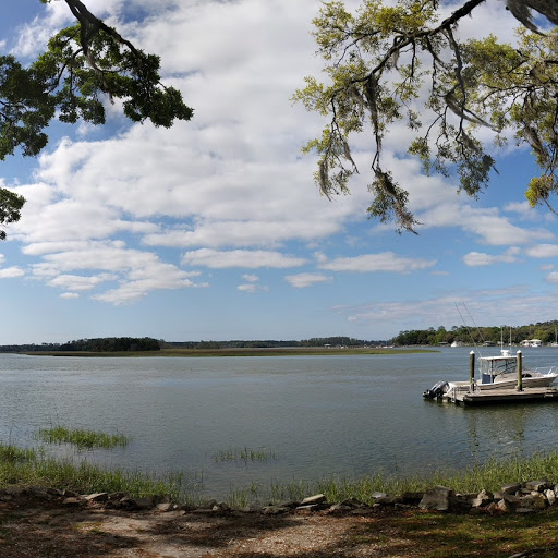
| The river, seen from our morning walk. Isle of Hope Marina is in the background. |
 |
| That's Raven on the right with the yellow diesel cans. David drove her right down that middle lane, with boats about 2 feet on either side of us. Needless to say, we went slowly and carefully. The marina crew were amazing. |
|
|
 |
| You can't miss us - just look for the Texas flag! |