Showing posts with label North Carolina ICW. Show all posts

Wednesday, June 13, 2018

Summertime

[Hilde’s log]

We’re beach weanies. I’m not much on sand (it’s hard to walk through and gets everywhere) and David doesn’t like the heat. Neither of us has much urge to swim in opaque water and be nibbled by anonymous critters. So we wandered out on Wrightsville Beach, took a couple of snaps, and wandered right back into town.


Wrightsville Beach - gorgeous white sand and hot white sun.

Then we found out that the only attractions at Wrightsville Beach are the water and the beach. David solved that problem by fitting out the sailing kit for the dinghy, and we spent a couple of hours sailing up and down the anchorage. He sails; I’m ballast; we both have fun!

Sunset at Wrightsville Beach.

A long, 40-mile day found us at anchor off Camp LeJeune at Mile Hammock Bay. We were so bushed, the occasional ordnance fire didn’t keep us awake at all. Early in the morning, smoke from fires set off by the “war games” woke us. It’s a nice anchorage, despite the army activity, and it was a relief to be able to stop for the night.

Our next stop was Swansboro, where the anchorage was shallow, but gave us a good view of the town, the highway, and various restaurants. We spend three nights there. Our second day, we dinghied in for breakfast at Yanna’s, which was spilling over with customers. A walking tour of the town took up the rest of the morning. That evening we dinghied in the opposite direction and treated ourselves to a fine Mediterranean meal. 


We admired this house's beautiful garden.

One of the streets in the historic district, Swansboro.

Stormy skies over Swansboro. This one blew past us without even a sprinkle.


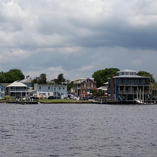
Swansboro - view from the water.

Here we are in the anchorage...before I ran us aground.

Our third day was not planned. As we were leaving the anchorage, I managed to ground us (again – this is my third time, I think; I am losing count) and we spend the entire frustrating day on board sweating and waiting for the shallow tide to rise and lift us off, which it did about 4 p.m. We went into the fuel dock for diesel and turned back to the anchorage for another night. Fortunately, David has a program on his phone that shows the contours of the bottom (sonar charts), so he downloaded this anchorage and we were able to leave without further ado the next morning.

The next day was another long trek, from Swansboro through Bogue Sound, past Moorehead City, and up Adams Creek. I remembered the anchorage at Moorehead City and was glad we didn’t have to stop there. It’s narrow and crowded and bad holding. We zipped past the town like a cat with its tail on fire: the current was running at 2.2+ knots with us and Raven flashed along at over 7 knots. That’s fast for us.

Underway from Swansboro under a beautiful summer sky. We have the jib out to give our speed a boost.
One of the huge working ships at the dock at Moorehead City. Check out the "little" boat (probably 20 feet long)  running along beside for a size comparison.

I love Bogue Sound. It’s a wide, wide expanse of water which is a delight in mild wind. We passed numerous pockets of tiny silver fish that flittered and leaped about on the surface of the water, creating water-borne glitter. I fantasized they were playing in the sun, but I’m pretty sure they were trying to avoid being lunch for the dolphins that surrounded us. 


The sound is broken up by islands and sand bars and coves. Houses line the shores, but they are so far away it doesn’t feel crowded. We passed one couple who had pulled their runabout up on a sandbar and debarked a couple of folding chairs and two excited dogs who ran back and forth on the bar, splashing and snapping at the water. Great idea! Pull up to your own little island and let the dogs run while you read the paper.

Neither of us remembered the views on Adams Creek, except we are both pretty sure it wasn’t built up ten years ago. Now there are three story houses on both sides of the Creek for quite a way. They finally peter out near the Neuse River. Cedar Creek is just a little south of the Neuse; Oriental is just across the Neuse River.

Arriving about 4 p.m., we anchored in 7 feet of water and spent a pleasant evening watching the world chug down the ICW. Fishing trawlers motored up and down with their nets out, and at one point two barges converged, one from either end of the channel. We were very glad to be anchored and not playing tag with those behemoths. When we came in, a lone catamaran was anchored near the shore. One other sailboat came in about an hour after we arrived, and then all was quiet.
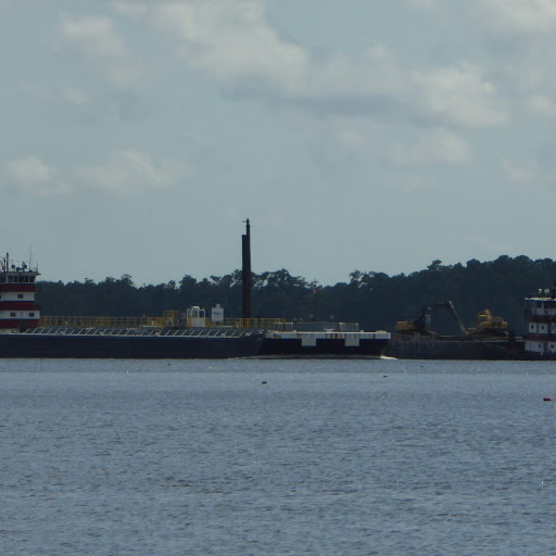
Nose to nose barges on the ICW off Cedar Creek.

We ended up sharing space with an entire commercial fishing fleet. They were the fishing trawlers we had been watching - seven boats that went in and out of their marina all afternoon and well into the evening, followed by a cloud of squawking gulls. In addition to the lone sailboat that anchored near us, the morning light revealed four more sailboats rafted up near us, flags flying gaily in the breeze. They took off later in the morning, but were replaced in the rainy afternoon by another three sailboats and a catamaran. We saw more sailboats at Cedar Creek than we’ve seen in the last two months!

We broke out the dinghy again and sailed all over the little bay. About eleven a.m. we heard thunder, and about noon a huge mass of black clouds appeared and roared through the anchorage bringing heavy rain and blessedly cool temperatures. The storm whooshed past, but left gray skies and constant rain for the rest of the day. It was a blessing – it was finally cool enough for me to cook something in the galley.

Rainy day on Cedar Creek.

It feels good to be back in North Carolina. It’s like East Texas with a lot of water. A lot of water. Last night I lay awake and listened to whip-poor-wills call in the trees; the air smells like wet pines. I am excited to be on the way to Oriental for a few days and then on to New Bern. We lived in New Bern for a year and we are both anxious to see how it has fared and whether we still feel at home there.

Monday, June 4, 2018

Glorious Summer v Too Many People

[Hilde's log]

The unparalled beauty of the Waccamaw River in summer

Being of the opinion that there is just so much natural beauty a person can stand, we have decided to enjoy civilization here at Wrightsville Beach for a couple of days. Just a barrier island away from the Atlantic, Wrightsville Beach is one of the vacation destinations here in North Carolina. After a week of soggy, stormy weather, we have been blessed with blue skies, dry air, and cool temperatures for the last two days. Both sides of the waterway and the Atlantic beach are lined with vacation homes and rentals full of happy vacationers, and the waterway bustles with watercraft of all kinds.

This afternoon we spent a delightful hour or so watching a sailing class made up of four optimist prams, two lasers, and a sunfish, with kids from age 8 to about 14 skimming across the anchorage, just off Raven’s port side, tacking, jibing, racing, and occasionally turning over their boats. They were having a blast. What a great experience and what a confidence builder! 

The colored sail is the Sunfish, the boxy little boats are the Optimist Prams, and the other two flat boats are lasers. David used to sail lasers and really enjoyed the show!

We had a ringside seat for the races. Watch the video above for the action!

The trip up from Georgetown, SC took us up a path we traveled down in the dead of winter ten years ago. I must say, I like the summer better! For better or worse, so do the inhabitants of North and South Carolina, who flocked to the coast this past weekend by the thousands. We were swarmed with jet skis, fishing boats, air boats, trawlers, power boats...all going along as fast as they could, swamping us with wake. We saw about three sailboats along the way. Probably everyone else headed for the Atlantic and sailed up on the outside.

After a particularly irksome afternoon at a beautiful anchorage beside the Waccamaw River, where a power boat with two middle aged people dropped the hook near us, cranked up their loudspeakers to earsplitting volume, and capped off three hours of togetherness by prancing about on the deck shrieking along to their favorite tunes before weaving away in the dusk, and after a long, hard day coming up the Waccamaw River through Myrtle Beach dodging hundreds of watercraft and suffocating from waterside development, we almost bailed out to the ocean ourselves. In fact, we got rigged to do just that, but a look at the map showed that we would have to backtrack almost a day to avoid troublesome shallows near the coat. So we took a deep breath and kept on going. Fortunately today is a weekday, so a lot (by no means all) of the rowdy vacationers have gone home.

Our anchorage, without the sound effects.

We spent last night in Pipeline Canal, where we spent a very cold week in December a decade ago. Like everything else, it improves in the summer. It’s a very shallow anchorage, though, really only easily accessible at high tide. We left as the tide was rising, but David still had to power through the soft mud through 4 and 5 foot depths (we draw 5 feet). Fortunately, the ground was soft. In fact, it’s kind of like tar. I remember we had a hard time getting the anchor set that week in December – we literally had to reset it about four times. I guess the “tar” gets hard in the winter. Yuck.

Pipeline Creek, in the early hours of the morning.

Pipeline Canal is just south of Southport, NC, which looks like a lovely place from the water. Hopefully we will stop there for a week on our way back south later in the summer.

The next couple of hours we spent on the Cape Fear River. A strong current kept us moving against a brisk wind, a combination sure to churn up the water. The good news was the 40 foot depth. I get tired of watching the depth meter…

We did have to dodge a couple of car ferries (above) and a barge tow, but otherwise it was just us and the wind. So cool!!

Braving another bevy of water-born vacationers along the coast, we dropped the hook here at Wrightsville Beach, where, rumor has it, there is a grocery and a seafood market not too far away.

Wrightsville Beach anchorage.

Monday, December 10, 2007

On the road again, sorta

[Hilde's log from December 5, 2007]

Ahoy, y’all. I’m sitting at the nav station aboard Raven enjoying a couple of days of R & R at anchor in Pipeline Canal, a small anchorage just to the west of Southport, NC, off the Inter Coastal Waterway (ICW). For those of you who don’t know, David and I have failed miserably to adapt to land life and have once again set off on Raven, this time heading south. We are aiming for St. Augustine, FL for Christmas, and after that will take a big breath and plunge eastward to the Bahamas. It’s not a new voyage for Raven, who spent three years in the Bahamas and Caribbean with her previous owner, but it’s a new trip for us. David bare boated in the BVIs in the 80s; I’ve never been to that part of the world at all.

One lure is the warmth – neither of us was looking forward to another winter on Raven in northern climes. When the weather is mild, you can sit out in the cockpit or on the cabin roof, you can read or do chores or wander around town if you feel like it. But when the wind pipes up and frosts your nose, you tend to become a badger, burrowing down in the cabin for warmth. Cozy as a badger hole is, it’s also dark, small, and claustrophobic after a few days.

When you’re underway, the cabin is just cozy and a welcome shelter after several hours at the wheel. Unlike some boaters, we have no enclosure for the cockpit, so when it’s cold, our noses turn bright red, our eyes water, and we drink gallons of hot tea. We also wear layers and layers and layers, and look a little bit like Robbie, Ralph’s younger brother in A Christmas Story, who looked like the Michelin man in his snow suit and couldn’t get up if he fell down. I routinely wear 5 layers on my torso, 4 layers on my legs, and a couple of hats, rubber boots, etc. If I ever took my hats off, I’d probably be appalled by “hat head” but they only come off when I wash my hair!

David bought a little propane heater before we left New Bern, and it keeps the cabin tolerable at night. We turn it off when we go to bed and the temperature drops rapidly. Schnitzel is curled up on the settee in her dog bed, wearing a sweater and covered in her blanket and often my jacket. David and I crawl into the v-berth on top of memory foam (ahhhh) and under a light blanket and our trusty sleeping bag, opened to make a full sized cover. We take with us a hot water bottle that toasts our feet. It gradually makes its way north to my stomach and keeps us warm all night. Our breaths frost the air in the morning, and David bravely makes a run for the propane heater to take the ice out of the air in the morning. We’re the comic sight, holding our clothes over the heater to warm them up as we wrap up for the coming day. As I said, warmth is a real draw!

This is the 6th day since we left New Bern on November 30th. We’ve wandered down the ICW the entire way, traveling through some beautiful marshland, large rivers, and narrow, shallow channels lined with houses. Those last are a bit like sailing down a city street and certainly aren’t my favorite byways. I was actually grateful for the military at Camp LeJeune because the land there is left wild and undeveloped, a peaceful and beautiful passage of marshland, scrubby shrubs and tall pines, lined by sandy banks and punctuated with big grey herons who hunch on the sand and look into the water, considering the possibility of breakfast. Of course occasionally the military is shooting the place up on maneuvers but they are kind enough to post that kind of activity and fortunately they were standing down as we passed.

We pulled in here to get out of the 25-30 knot winds (although we did get in some great sailing coming down the Cape Fear River) and the choppy waters. We’re trying to take it easy as we wander southward, and to rest a couple of days a week at a conducive anchorage. Tomorrow we up anchor and head for South Carolina, which I hope is at least 5 degrees warmer. It was actually quite nice this morning, and I sat out on deck for about an hour, putting another coat of teak oil on the port toe rail. We enjoyed a dinghy into land and a longish walk, with Schnitzel even getting to run off leash. But then the temperature took a dive, so I came in and made a casserole to heat up the boat and my guess is we’ll pass the afternoon reading, knitting, chart-plotting, and washing up (always washing up).

Wednesday, December 5, 2007

Pipeline Canal - Southport, NC


[Cap'n Dave's log]

Hi! Everyone:

It’s been over one year since you received tales of our travels on Raven. We are on the move again. 


We arrived in New Bern, NC, in October 2006, in time for the Southbound Cruisers’ Rendezvous. After six months of living aboard and over 4000 miles under the keel (from Galveston, TX, to Islesboro, ME, and back south to North Carolina) we were exhausted and ready for a break. We became enchanted by New Bern and early in 2007 decided to settle there. Our vision included part time jobs and time to sail on Pamlico Sound. Reality became more and more like the life we had left behind: long hours, no time off, and this time for little pay. When the Sheraton Marina doubled the dockage fees, we would have had to give up downtown living and add a commute to our lives. Enough! We began to convert Raven from live-aboard mode to cruising mode. Stuff had to be sorted, pared down, and stored. Maintenance that I’d ignored for too long had to be done. We got it all done just before the rate increase came into effect. We left Friday, November 30th, 2007.

The trip down the Neuse River was in sunshine but very cold. The air temp was 58 °F and the chilling effects of a 15 knot breeze easily penetrated our clothes. We toughed it out, enjoying the brilliant colors and the familiar scenery. Raven’s cabin was still a shambles, with clutter everywhere. All those last-minute “essential” supplies that hadn’t yet found permanent homes were scattered on settees, the vee berth, and the cabin sole. I knew that we’d sort it all out eventually – or heave them all overboard.

We turned into the Adams Creek Canal and settled into Cedar Creek for the night. One boat was already there and two more followed us in. It was wonderfully quiet, almost too quiet, causing our ears to ring. The familiar traffic sounds from Highway 70 had disappeared, replaced with bird calls and the gentle slap of water against the hull. We slept deep and hard.

We woke with the sun and got under way first thing. We find that having breakfast at anchor makes for a disproportionately late start. We prefer to get going, then enjoy breakfast as a warming snack as we travel. The air is always chill on the face at this time of year, so a hot cup of tea or coffee heats us from the inside.

Adams Creek Canal is relatively undeveloped compared to much of the Intracoastal Waterway. Other sections of the ICW are about as natural as Disney World. Large houses lie side by side, each one challenging Snow White’s Castle for grandeur. Many of them appear to be unoccupied; the yards are bare and no lights burn inside.

We negotiated Morehead City, passing under Highway 17 and past the large silos and warehouses. Both landmarks had become familiar to us on road trips to Beaufort, a town as charming as New Bern.

Just before dark, we turned into the harbor at Swansboro. We anchored between red #4 and the road bridge, per cruising guide instructions, but I doubt that we were out of the channel, as suggested. The waterfront buildings reminded me of Rockport, MA. At night, the windows were lit like a decorative Christmas village. We didn’t look too hard, instead preferring to hover over our little propane heater below. It was mighty cold.

We left Swansboro on Sunday morning at 0730, surprised at that hour to be the last of three boats to leave. We had no good plan for an anchorage that night. The closer of two possibilities was Sloop Point, which on the chart looked like swamp in the middle of nowhere, with a narrow, tricky, poorly marked channel. Further on was an nice looking anchorage at Wrightsville Beach, at the end of Motts Channel, which appeared to be narrow but well marked. It would be a late arrival, after dark. That became one element in our running aground.

Early that day, we managed to bump the keel at Green #61A. It was a temporary mark that indicated shoaling from an inlet. We found a way through about two boat lengths from the mark. It was, apparently, positioned in shallow water. S/v Gem, one of the two boats at anchor overnight in Swansboro was kind enough to hail us with a warning while they waited for the Onslow Beach Bridge to open. Their warning allowed us to slow to a crawl, so backing off was easy and I just gently tried different spots until Raven eased through.

After Surf City Bridge, which we timed to perfection, we came upon Sloop Point. It was as uninviting as we had feared, so we pressed on to Wrightsville Beach, undeterred by an arrival after dark. By setting waypoints for Figure Eight Island and Wrightsville Beach bridges into the GPS, we were able to arrive at each just prior to their scheduled openings. At the latter, I was already concerned by how dark it was, in spite of the city lights. Only a few hundred yards after passing the bridge I made the left turn into Motts Channel. I don’t know if the current carried us faster than I anticipated or if I was confused by the chart plotter being set to show “track up” instead of “north up”, but I made the turn at Green 25 too wide and put us hard aground. I could swing Raven to port or starboard using the rudder in forward, but she wouldn’t budge in reverse. We were broadside in the channel and clearly a hazard. I called Tow Boat US on the VHF and thirty minutes later we were secure at Dockside Marina and Restaurant, a mere 100 yards across the ICW from our grounding.

I can’t speak too highly of Tow Boat US, or of Boat US insurance. Each year, we cough up $120 for unlimited towing insurance. It is one of the few bills I don’t mind paying. I try not to use it, of course, but I was glad of it on this occasion. The bill for thirty minutes work was almost $600: time, gasoline, wear and tear for towing, and a premium for Sunday evening, I expect. The operator was cheerful and, more to the point, skillful. He passed me the one-inch polypropylene line, with instructions to attach it to something substantial. On Raven, that meant through a bow chock to one of the 8” bronze, foredeck cleats. Everything about a Cape Dory is “substantial” but I was momentarily worried when Raven tipped to twenty degrees or so as the bow was pulled around.

We enjoyed a couple of beers each in the restaurant bar, then walked back down the ramp to the fuel dock where Raven was dwarfed by a 70’ motor yacht tied within ten feet of her transom. Hilde rustled up some wonderful hot food and we were soon asleep, from too much excitement and good living.

Some early Monday morning rain arrived with very mild air, although the breeze was strong. We checked the weather forecast and decided it was better to travel when the air is warm and take our lumps with the gusts. We topped up the water tanks and dumped our trash. Neither diesel nor a pump out was available, but we were not desperate for either. We had been cruising with (our engine) Big Blue turning at only 2000 rpm, burning only half a gallon of fuel every hour. Just before we shoved off, Chris, a friend from New Bern, passed by on m/v Victory. He yelled greetings to us and we chatted on the VHF. Shoaling was bad at Masonboro Inlet, where Chris ran aground and was rescued by Tow Boat US. I got Raven through with one minor bump. My muscles were taught as bow strings, my dreading having to be rescued by Tow Boat US two days in a row. All was well until Carolina Beach Inlet, where Raven hit hard on the shoaling, marked by a temporary red buoy #152A, that forced us into the blue shallows of the chart plotter, far from the magenta line that indicates center channel. I was horrified, fearing my nightmare was coming true by the minute. This time, Raven backed off OK and I tried going by on the wrong side, closer to the magenta line. No go! I could see the shoaling across the supposed channel. I tried again, leaving the mark to starboard. No go! Was this an ICW mark or a returning channel marker for the inlet? There was no yellow reflective patch denoting an ICW mark. The reflective patch was red, which on a red buoy didn’t make any sense. Finally, with the red buoy about a boat length off starboard, Raven seemed to bump her way through. We touched several times, sometimes feeling like we were atop two sand ridges. It was not a good time, although I was hugely relieved once we were though.

We selected Pipeline Canal, just past Southport, as our anchorage for Monday night. It is “dog friendly”, according to the cruising guide and we didn’t want to force (our Schnauzer) Schnitzel to “explode” as she’d had to on Sunday. The current in Swansboro had been too strong for my dubious rowing skill, so Schnitzel had had to “bottle it” for over twenty-four hours. Our outboard motor had croaked our first night out. The fuel contained water and sludge. I managed to remove and clean the carburetor on the bridge deck, while we were under way and the weather was warm. I was delighted when the motor roared into life.

The cruising guide also mentioned a submerged dam at the entrance to Pipeline Canal. By this time I was phobic about running aground, but I was encouraged by our estimated arrival exactly at high tide. We entered the canal with three feet under the keel and discovered a beautiful, protected anchorage. Protection was a high priority since it had been blowing a steady 25 knots all afternoon, with gusts over 30. Although it was the peak of high tide, the flood was still running west into the ICW against the strong west wind, causing two feet tall standing waves that all but stopped our progress as we chugged west along the channel, with Big Blue spinning at 2500 rpm. Our run down the Cape Fear River from Carolina Beach to Southport had been a thrilling motor sail into the wind. The staysail helped us against the flooding tide but caused Raven to heel 20 degrees. At least on this stretch the wind and current were running together. It was huge fun to use the many lighted range marks, just like the big ships.

We had terrible trouble setting the anchor in the basin. After five tries with the CQR, we abandoned it in favor of the Danforth. It, too, refused to set, even with careful lowering by hand. Finally, I added twenty feet of chain between rode and shank. The extra weight kept the shank low and we haven’t budged since.

Tuesday, December 5th, 2007, we stood down and relaxed. We took Schnitzel ashore mid morning; the dinghy motor worked great. We walked the shoreline of the canal. We took the dinghy up the canal for a joy ride.

Wednesday, December 05, 2007, we again took Schnitzel for her morning walk along the canal, ending up at the entrance from the ICW. We stood in the still-brisk breeze and watched three motor yachts and one 40 foot plus sailboat chug their ways westbound. So far, so good!

My salient memories of the trip from New Bern so far must be the multiple groundings, more in the last few days than in many years of sailing. It is an inevitable part of the experience and usually not life-threatening. Nonetheless, my neck and shoulder muscles are still tense from hours at the helm, willing Raven safe passage through obviously dubious channels. It has convinced us to avoid Georgia’s ICW, especially since the entire state is under severe drought conditions. Weather-permitting, we shall hop from Beaufort, SC, to St. Mary’s River, on the Georgia-Florida state line.

Best regards to you all.